I4D Intelligence: Geospatial Analysis & Multi-Source Data Fusion
From strategic monitoring to operations planning and tactical execution

Key Features
What is I4D?
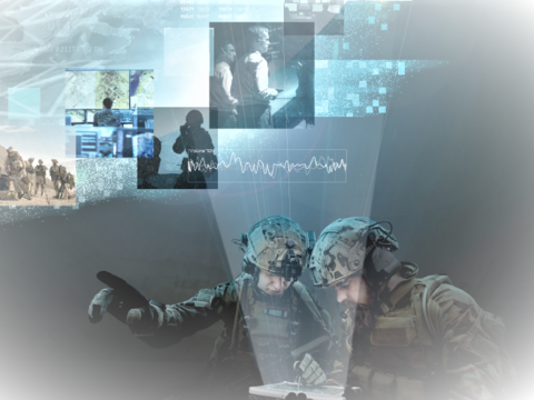
I4D is a cutting-edge GEOINT solution designed to retrieve, visualise, analyse, merge and correlate heterogeneous and exogenous data sources for geospatial analysis. I4D provides a comprehensive set of tools for geospatial analysis and report generation, all within a single interface. Used across the entire chain of command, I4D supports everything from strategic intelligence to tactical mission preparation.
Developed in collaboration with the French Ministry of Defence, I4D can be deployed as a stand-alone application. Its capabilities extend across Air, Land, Navy and Joint operations, as well as civil applications such as urban planning, pandemic response, natural disaster management and crisis response.
Your Advantages with I4D
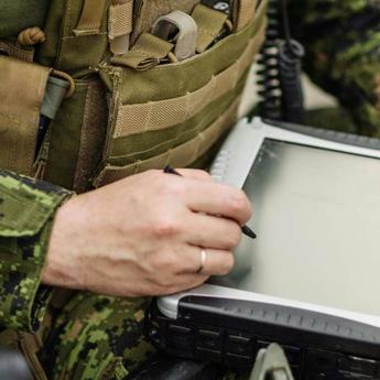
Accessibility
An expert tool, easy and quick to learn.
Time-Saving
A seamless workflow from data collection to report production all within a single interface.
Interoperability
Compatible with OGC standards and various geospatial formats.
Reliability
Provides accurate and up-to-date data for reliable analysis.
How to Tackle Today's Challenges?
Accurate Decision-Making
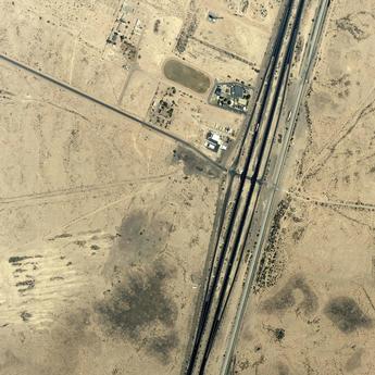
GEOINT integrates imagery intelligence with additional data, including temporal dimensions for precise insights.

Multi-Source Data Fusion
Intelligence reports can incorporate multi-sources such as COMINT or OSINT, leveraging temporal data for enhanced situational awareness.

Defence & Military Intelligence
Supports counter terrorism efforts and military situational awareness for strategic operations.

Ensuring Protection
Information Sovereignty
GEOINT analysts rely on I4D for critical tasks such as terrorist threat analysis and border monitoring. By integrating satellite imagery and geospatial data, I4D enables seamless data analysis and fusion within geographical views.
This empowers analysts to make fast, informed decisions using up-to-date intelligence reports ensuring efficient dissemination based on the need-to-know- principle.
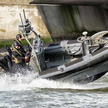
Maritime Protection
As a powerful data fusion tool, I4D enhances maritime situational analysis by tracking successive AIS positions at sea. It correlates this data with other sources such as satellite imagery and OSINT to identify vessels displaying abnormal behaviours.
I4D is also valuable when ships disable their AIS, helping analysts determine their actual location and improve overall maritime security.
Want to speak with sales?
Our sales team is happy to provide more information about I4D and how it can meet your needs.
Explore more possibilities
Download
Browse all our documentation about I4D Intelligence for Decision.
Documents
I4D Brochure 2023
Documents
I4D Brochure 2023
Related Pages
-

Fortion® Multi-INT Centres
The Multi-INT Centre equips the intelligence community within the armed forces with all the tools necessary for managing the…
-

IMINT and GEOINT Centres
Explore our modular IMINT and GEOINT Centres with advanced solutions to boost decision-making via real-time, multi-source data.
-
Fortion® CSD
Fortion® CSD is the solution for secure information sharing in highly sensitive environments


Keep up to date with our latest news
In the Spotlight
-
HumINT: Break Language Barriers
Case Study
ISR
In army operations, forces need to interact with their surroundings as quickly as possible without language-related challenges causing delays. -

At the Heart of Intelligence-Led Operations
Case Study
ISR
-
Border Monitoring with Strat-Observer
Case Study
ISR
-

AI Contribution in defence
Case Study
Big Data
-
Improving Coastal Surveillance Missions with STYRIS®
Case Study
Maritime


