Fortion® Terra Analyst
Boost your geospatial data capabilities with the Operational Image Exploitation System

Key Features
What is Fortion® Terra Analyst?
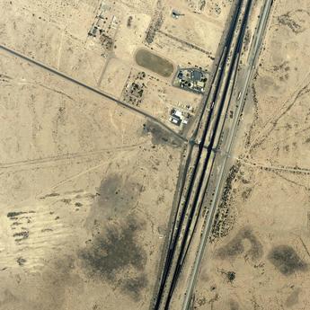
Fortion® Terra Analyst is an intuitive, efficient solution that quickly extracts valuable information from satellite images, no matter what your experience with geographic imaging is. It provides easy access to vast amounts of geospatial data without the need for complex pre-processing.
How can Fortion® Terra Analyst support you?
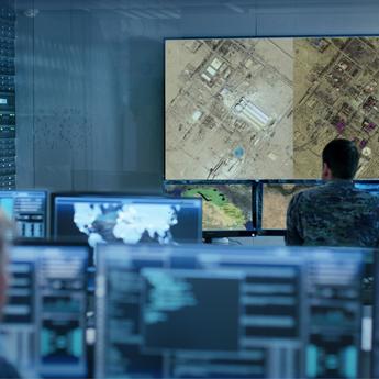
With Fortion® Terra Analyst, image analysts can:
- Instantly examine satellite images
- Launch powerful analytics (vehicle, ship, airplane, and building detection)
- Create detailed vector maps with semantic information
- Prepare comprehensive analysis reports using standard tools
This cutting-edge tool enables precise detection of specific objects in satellite imagery, streamlining the process of converting data into actionable insights.
How can Fortion® Terra Analyst support your organisation?
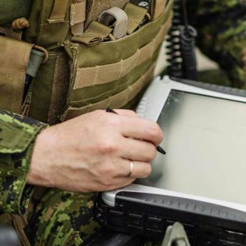
Its intuitive interface significantly reduces training time, making satellite data easily accessible to all users and decision-makers across global organisations.
Did you know?
Originally developed for military use, Fortion® Terra Analyst is designed to provide up-to-date data to aid quick, informed decision-making.


Your Advantages with Fortion® Terra Analyst
High-Performance 2D and 3D Preview
Compatible with other Airbus solutions or customer-specific systems
Major Image and Vector Formats Supported
GeoTIFF, COG, JPEG2000, ECW, NITF, CADRG
Fast Analytics for Image Analysis and Annotation
On-demand automatic object detection (ground vehicle, ship, aircraft, building)
Fast and Easy Report Creation and Publication
Publish to Geospatial PDF, GeoPackage, JPEG2000, GeoTIFF, Shapefile, KML
Want to speak with sales?
Our sales team is ready to provide more information about Fortion® Terra Analyst and how it can meet your specific needs.
Explore More Possibilities
Browse our documentation about the Fortion® Terra Analyst
Documents
Fortion Terra Analyst Flyer
Documents
Fortion Terra Analyst Flyer
Related Pages


Keep up to date with our latest news
In the Spotlight
-
At the Heart of Intelligence-Led Operations
Case Study
ISR
Airbus’ solution supports the defence intelligence community through the provision of tools, functions and capabilities for intelligence-led operations. -
Border Monitoring with Strat-Observer
Case Study
ISR
-
HumINT: Break Language Barriers
Case Study
ISR
-

AI Contribution in defence
Case Study
Big Data
-
Improving Coastal Surveillance Missions with STYRIS®
Case Study
Maritime


